Entry 17 – Canberra to Victoria’s Great Ocean Road 26th Oct to 9th Nov 2022
After 11 nights at Canberra in a caravan park it was time to move on. Consistent with the weather conditions during our stay, we departed in the rain.
Vast amounts of the Australian country side was “significantly,” water logged, from within a metre of our caravan park cement slab site and included many/most areas thousands of kilometres away. Viewing NSW, Victoria, Queensland and South Australia current road closure maps, revealed large areas affected by flooding, with maps covered by red scribbly lines showing roads closed, impacted by flood waters.
We found ourselves reviewing the conditions for a plethora of possible/wish list locations attractive to us. The “once in 200 years,” wet weather event had thwarted any possibility of us participating in most of those special locations we loved.
We decided to make our way toward Victoria’s, Great Ocean Road region. This decision was primarily based on “no,” red scribbly lines when viewing the areas road closure events. We were mindful of the wet conditions, restricting our travel route and camp locations along the way.
Back in 2015 we had got horribly bogged when a large overhead cloud targeted us for a different life experience. We have √ off that life experience and don’t wish to experience it again!
It was nice to be travelling again, feeling good not having any specific time line pressures. Thus, after driving for about 110 kilometres, we decided to set camp for the day.
Jugiong community recreation grounds looked good. The Murrumbidgee River was flowing fast alongside the campground. Further down the road (Aussie slang - could be a couple of kilometres or a thousand or so kilometres) the Murrumbidgee River was overflowing its banks, impacting a few towns and roads.
We walked around the recreation grounds, selecting a not as wet spot up above the river.
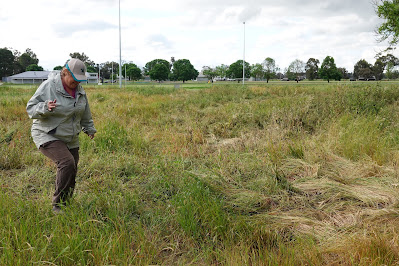
The recreation grounds were covered by lush green grass. Walking about during our inspection we saw the grass was camouflaging large boggy areas covered by water. It was interesting watching people drive into the recreation grounds with caravans in tow, driving across large grassed areas without thought of possible conditions.
Leaving Jugiong, it was reiterated how water-logged vast areas of land had become. It added to our nervousness with thoughts for safe camping locations.
We decided to travel the Olympic Highway from Wagga Wagga to Albury, a first for us along this route. On the outskirts of Wagga, we stopped at the RAAF Wagga, Aviation Heritage Centre. It was interesting viewing some of the past RAAF aircraft. There was plenty of interesting information in the heritage centre showcasing memorabilia of over 80 years of Air Force history. There was a lovely picture of the type of plane Mary’s dad spent time in during WWII
Our first planned stop was at the township of The Rock. The towns free camp location at the sports centre looked beautifully inviting. We backed into a spot and were instantly swamped by mosquitoes. It was quite confronting, unsettling us and we un-decided our desire to stay.
Just a bit further down the road was the township of Yerong Creek. The camping area at its showgrounds looked ok but underfoot it was very water logged. There was a wonderful mural on the towns water tower. It was another small country town in decline with nothing enticing us to stay on
Just a bit further along was the township of Henty. We turned off the highway onto the town’s main street, with our eyes immediately tantalised by the first building in the street, a lovely old pub with a catchy name.
Just a bit out of town we set camp at Henty Showgrounds. We decided to walk into town for a closer look at the town, viewing some beautiful old buildings. We took a short cut across the oval only to find the outer perimeter rather water logged. There were some grand entry gates to the oval. On our return walk we stuck to the black top paved road.
We woke to another rain affected day. We continued along the Olympic Highway looking at another couple of towns before settling for the night at Benalla. There was a free camp near the centre of town with a beautiful setting. By night fall the free camp had become rather crowded with double the imposed limit of vehicles in attendance.
We had been travelling through the “Riverina Region,” viewing a small portion of this area, immensely enjoying its sights. Another location to add to our wish list for exploration during not so wet times.
In the morning we completed our food shopping for the next week. It was the start of a four-day long weekend in Victoria. Luckily there was no need for us to find somewhere to camp over this period. We had been invited to stay down the road about 30 kilometres at Violet Town.
We parked in the front driveway of Ann & Brian’s home, fellow caravaners we met in 2015. We had caught up with them several times since, enjoying their company each time we got together.
It was Melbourne Cup long weekend, the horse race that stops the nation. Brian and Ann had invited some friends around for a Melbourne Cup luncheon. We helped out with the food preparation. A fabulous meal with lots of good conversation.
Melbourne Cup is held on the first Tuesday of November. It was the coldest temperature recorded for a Melbourne Cup Day and true to the past months form there were some heavy periods of rain.
October 2022 had been the wettest October on record for vast areas of Australia. There were still many locations out of bounds due to ongoing flooding or sustained damage.
It was close to ten years with our focus on travel during our retirement years. This had been our first experience where we had been inhibited for selection of Australian destinations due to flooding.
Leaving Violet Town our next destination was to be at a caravan park in the town of Airey’s Inlet. We were on the Melbourne side of the “Great Ocean Road,” drive. It is a scenic drive with large sections along the oceans edge. It starts at the town of Torquay, meandering to the town of Port Fairy. A distance of about 664 kilometres. There are some special hazards to be on lookout for.
It is a beautiful scenic location, most pleasing on the eyes.
Unfortunately, it is an area controlled by commercialised enterprises with camping options for us, restricted to mostly caravan parks. We accepted this begrudgingly, spending our time focused on the scenery and attractions. Though our caravan park experience didn’t provide much in the way of enlightenment.
The township of Airey’s Inlet was similar to other nearby towns of Anglesea and Lorne. It was a beachside bush setting with housing set amongst trees and bush. We walked amongst the streets and along some of the many walking trails available. All adding to a pleasant enjoyable setting.
We spotted the silhouette of a lighthouse in the distance, enticing us to follow a walking path along the top edge of a cliff with ocean waves crashing below into its base. Arriving at the lighthouse we started to read some of the displayed literature about the lighthouse.
Instantly we both became excitable. Un-be-known to us the Split Point Lighthouse was the featured lighthouse for our much-loved Australian TV series “Round the Twist.”
Some of the literature showed the lighthouse was open for viewing in the mornings. We reattended the following day, paid our entrance fee and we were in!
It was rather small inside in comparison to the how it had been presented on the TV. Evidently most of the filming was staged at a film studio. It was still exciting accessing the “Round the Twist,” lighthouse. Adding to another pleasurable “special,” day the constant wind decided to subside enabling us to enjoy the scenery from the upper reaches of the lighthouse.
We reattended after sunset for a different perspective of the lighthouse. Of interest it was still an operational light house. The upper area with the light fixture was out of bounds. We could see the LED looking light through the screening. It appeared to be about 50 millimetres in diameter. We were informed by the guide the light could be seen up to 40 kilometres away
On another day’s beach walk the lighthouse was still within view providing ongoing inner warmth.
Large areas along the Great Ocean Road drive are protected by the Great Otway National Park. We spent time in the National Park nearby the town of Anglesea enjoying the wild flowers. Evidently it was a good location for spotting Orchids.
Another day we spent time in the National Park nearby the town of Lorne. We walked to Erskine Falls. It was a good feeling driving amongst the large treed forest environment and the falls walk provided a good cardio work out.
We did partake in some of the commercialised activities, like viewing a chocolaterie.
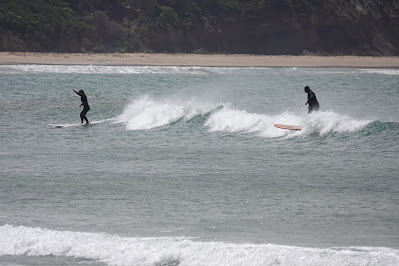
After four nights at Airey’s Inlet, we moved further along the Great Ocean Road. It is a pleasant drive with plenty of opportunities to stop and view the scenery. We stopped to watch the surfers riding the waves, with plenty of accessible surf spots provided by the construction of the road.
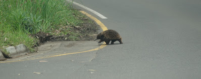
Our stop for the night was at a location in the Great Otway National Park, Jamieson Creek campground. It had a splendid vista; with an environment we thoroughly enjoy. We were even provided with a greeting from some of the locals when we arrived.
We sat at one of the campground tables for dinner and breakfast enjoying the view overlooking the ocean. There was a great walking trail from the campground.
We decided to move on past the commercialised, restricted locations of the Great Ocean Road drive and aim for those more natural “National Park,” settings. A drive of about 70 kilometres down the road to available camping locations.
Not so long ago you could drive to a National Park campground setting, make your own assessment if it was acceptable for your desires or not. If it was a yes you would select a site and pay your fees into an honesty box or directly to a park ranger whom collected fees during the day. Times have changed. We are now required to use the national parks internet site, select a camp site and pay, prior to arrival. In this instance the result showed how frustrating this system can be for many reasons.
It is hard to obtain current descriptions of camp grounds. We decided on Johanna Beach or Aire River East / Aire River West campgrounds. Most sites were booked at Johanna Beach indicating it might be crowded. We decided on Aire River West with minimal sites booked.
We arrived at the Aire River West campground to find there were two large school groups camped next to the only toilet block. There was the constant noise from excitable kids and they seemed to be everywhere. We could see it was a great location for school camps. But this was not what we thought the camp ground had been portrayed as. Grrr. We had a look at the Aire River East campground hoping for a quieter location to find the entrance gate was shut, possibly due to a water-logged ground. So, we made do. Thankfully it was a rather nice setting.
The next morning, we woke to a magnificent blue sky. It felt good, lifting our spirits. It had been way too long since we had experienced an Australian blue-sky day, reminding us not to be complacent with what we take for granted - Great Aussie weather. We walked along part of the “Great Ocean Walk,” which passed through the campground. This walk starts at Apollo Bay following the coast line to the 12 Apostles. An eight-day hike of over 100 kilometres.
Our second night at Aire River Campground we witnessed a rare lunar eclipse. The rising moon slipped into the shadow of the earth. When the moon is in full shadow it turns red or as it is called, “a Blood Red Moon.” Even on the other side of the horizon the sunset was putting on a good show. It was good being out bush away from the interference from city lighting.
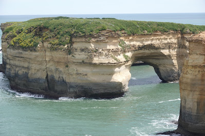
Once again, the weather forecast was for more rain. We decided to get some more scenery viewing in before the arrival of the rain. We headed down the road to the area nearby the 12 Apostles, a spectacular section of the coastline. This section of Australian coastline is much publicised, especially towards overseas tourists. It was a busy location with lots of overseas tourists about. There was a good ocean swell either announcing the arrival of another front or still strong from all the storm activity of the last month. There were plenty of surfers about all along the coast line enjoying the large wave activity.












Good to see your out and about. We got home about a week ago after a water soaked trip to Sydney, Corryong [to muster], Melbourne, Sydney and home. 10,500k in 3 months. Never done that many Ks in such a short time. Sue is doing well, she has a MRI on monday then appointment with doc a week later. Take care. Michael & Sue.
ReplyDelete