Entry 20 Coolah, N.S.W. to Canberra 24/10 –
5/11/2019
Leaving Coolah Tops N.P. was harder
than we anticipated with our instincts wrestling the move. It was a slow
departure eventually heading out at around 11.30 am, propping at Coolah for
food, reinflating vehicle tyres, attending to copious amounts of electronic
stuff including up-loading the previous blog edition while we had that rare
access to phone reception. It took best part of 3 hours to complete these
chores, leaving us feeling rather exhausted. We do love the positive well-being
feelings provided by remote nature settings in our national parks. They do come
at a cost, like when returning to today’s modern world with our phones making
all sorts of noises notifying of copious messages requiring attention when
reception next catches up with us.
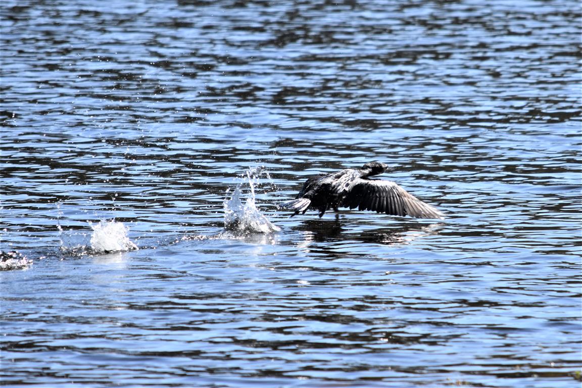
 |
| Even the wild life seemed to decide not to be as allusive on departure day |
 |
| And the dirt track looked daunting travelling back down the mountain range |
We inspected a free camp location about
35 kilometres down the road from Coolah and decided to give it a miss due to a
gut feeling, ‘not feeling right/safe,’ continuing down the road.
Our next targeted camp was at Goulburn
River National Park arriving late for us at about 6 pm. Once again, we were the
only campers present and set camp utilizing one of many tables provided, a
first for us, where we positioned the caravan to utilize our awning as shade
over an existing camp table. Probably made possible by the recent fitment of a
new awning on our caravan which operated quite differently from our previous
one.
 |
| Admiring our surrounds with our awning extended, providing shade |
When we were getting close to Goulburn
River N.P. we ticked off another one of our wish list items, seeing a wombat
roaming about in the wild. We may have contributed to ✔
by being out and about late in the day when wombats emerge for their night time
food foraging.

We were camped at Spring Gully
campground with a nice landscape. We enjoyed breakfast outside without annoying
flies admiring our surrounds & watching the birds.
 |


 |
| First there was a lone emu wandering nearby |
 |
| a bit later there was another emu with chicks in the gully below |
We had little information about this
N.P. only becoming aware of its presence from spotting a green patch on a map. Reading
the notice board in the campground, it showed there were two campgrounds set on
the banks of the Goulburn River about 1 kilometre apart. The Goulburn River
meandered for about 90 kilometres through the N.P. There were no defined
walking tracks with a recommended walk along the edge of the river at times of
low water between the two campgrounds equating to a distance of about 4
kilometres. To be prepared to get wet feet with a recommendation to allow 2-4
hours to complete this walk.
We walked along the road to the second
campground for a look and see. It was also empty with a similar vista, where we
spent time just admiring the surrounds.


During the day we had the pleasure of
speaking with a young Ranger, Michael. Michael provided descriptions about
another couple of national parks unknown to us along our intended route for
camp considerations. Suddenly we felt time limited, with a due date of arrival
at our sons’ home in 12 days’ time, about 500 kilometres down the road.
We had initially thought an allocation
of 3-5 days sounded ok for Goulburn River N.P. After hearing descriptions about
the additional national parks from Ranger, Michael we decided to move on after
two nights hoping to experience a bit of time, viewing each of the national
parks along our planned travelling route. We stopped at Mudgee for the night
choosing to stay in the towns showgrounds where we restocked our pantry and
fridge with enough food for the trip to Canberra.
 |
| Another sign of country town in decline ‘going to the cows.’ |
We did attend the Mudgee visitor
information centre seeking information about the local national parks and other
nearby attractions. We were informed we would need to conduct our own enquires
via the internet. It appeared the Mudgee Information centre’s primary focus was
to promote the commercial activities of many nearby wineries. For us it was sad
to see a primary focus on ‘alcohol related,’ activities.
We spent quite some time during the
afternoon, into the evening on the internet researching NSW national parks web
site finding it not very user friendly. We left Mudgee as soon as we could,
feeling frustrated with the national park web site and the lack of tourism
assistance provided by Mudgee.
At least the weather and scenery were
pleasant for our drive of about 80 kilometres to our first national park stop, helping
to calm our frustration.
Ganguddy / Dunn Swamp campground had
been our primary goal travelling through this region. We had heard many
positive comments about this location from other travellers over the last few
years.
It was an interesting drive with the
road travelling through farming lands with the last 10 kilometres or so
changing to a dirt surface where we felt like we were being herded into a gully
with our surrounds closing in on us.


Once we were within the national park grounds,
we resumed the smiles position constantly looking left, right and up. We walked
around the campground selecting a suitable location for our caravan.

We set camp and spent the next hour or
so wandering around the campgrounds outer perimeter delighted with another most
magnificent setting.
 |
| What a sight – the campground set next to these waters |
 |
| We found ourselves constantly looking at the scenery all around us |
Waking just after sunrise we decided to
walk the weir track before breakfast. It was promoted as a 45-minute walk. We
were constantly stopping admiring the scenery and loved listening to many
varieties of bird chattering’s getting back to our camp a couple of hours later,
looking forward to some food and a cuppa.


 |
| Us standing above the cliff face from the previous photo looking back down the water way |


 |
| The previous 3 photo’s shows us scampering around the base of the cliff face to the right of this picture |

 |
| It was a great location for canoeing |


The Cudgegong was another enjoyable
walk skirting around the water’s edge in the opposite direction from the weir.
There was the delightful constant background noise of various birds singing.


 |
| Our camp was in those trees |

We thoroughly enjoyed our time at
Dunn-Swamp and could have easily stayed a week. It would have been extra
special if we had canoes for a different perspective view, looking at the sandstone
cliffs from the water. We did like all of the available walking trails starting
from the campground.
Dunn Swamp campground would definitely
be a worthwhile return destination.
 |
| Our final sunset at Dunn Swamp campground |
Our next planned stop as recommended by
Ranger Michael was Capertee National Park about 70 kilometres down the road. It
was an easy drive along quiet back roads with few other vehicles encountered
even though we were not far from the outskirts of Sydney at about 200 kilometres.
Capertee National Park came into
existence in 2010 when it was acquired from the farm owner to protect the
diminishing habitat, needed to help preserve the critically endangered Regent
Honey Eater birds. Thought to be less than 400 in existence.

Basically, we set camp in one of the
farm paddocks where national parks had installed an environmental loo. The old
farm house and a nearby cottage were also available as accommodation for park
visitors. There was still scattered shedding, stock yards, shearing shed and
implements lying about. A typical farm.

 |
| An interesting wooden trough, not made of steel or cement! |

It was mid spring with the country side
looking dry and dusty plus day time temperatures already in the low 30’S. It
seemed the winter rains had failed to arrive in this region with the Capertee
River bed looking dry.

In the afternoons we walked along the
mostly dry Capertee River (a few small water pools all containing stagnant
water) with many kangaroos poking about on the dry river bed, grazing on
grassed sections. The river banks were littered with wombat holes and we saw a
few wombats sunning near their house entrances just prior the arrival of night.
 |
| Look at the long arms |
 |
| A different colouring with short arms |
 |
| More different colouring |
 |
| Strong looking claws |

 |
| Jumping high |

There was a delightful, constant
background noise of bird chatter walking nearby the river.

 |
| Red-rumped parrot, |
One day Steve spoke with the ranger who
said he had just closed the section of national park at Coorongooba campground
due to a nearby bush fire. This was our next planned camp location about 40 kilometres
away. Steve’s brain cogs started ticking over where he fired off many questions
at the ranger, clarifying our safety and the condition of the fire. The park
had been closed as a precautionary measure, if the fire (located on the other
side of this N.P.) suddenly changed direction towards us, we would have a
couple of days before it got near us. He did say we could stay at Capertee for
as long as we liked.
We tuned our radio to the local station
which we monitored for a couple of days and there was no mention of any
hazardous nearby fires other than some smoke haze drifting across from the Blue
Mountains which was close by. And we did get enveloped by a smoke haze later in
the day. We had checked the national parks web site for ‘alerts,’ prior to leaving
Mudgee (5 days prior) whilst we had internet access and there were no potential
hazards of concern for us at the time. A timely reminder, the consideration for
checking ahead for any hazards we could encounter along our route, especially
when travelling to remote bush locations.

Capertee N.P. was another enjoyable
location and it would be interesting to view it when not in drought conditions.

 |
| Another tree lying down with Mary doing her best to help |
 |
| There was still a reasonable amount of infrastructure left over from the bygone colonial days |
 |
| What's an Aussie bush setting without the occasional red bellied snake |
We had spent three nights at Capertee N.P. and the smoke haze wasn’t dissipating, so we decided to head down the road about 150 kilometres to the township of Oberon, nearby the tourist town of Jenolan Caves. We were hoping to camp at the town’s lake for a couple of nights utilizing it as a base while we drove out to view the Kanangra Wall near Jenolan due to the road marked as unsuitable for caravans.
We drove past the national park that
had been closed due to the nearby bushfires. It did look like an interesting
location to explore for future reference.


As it transpired that was the one
weekend (it was a Saturday) in the year when there is a fishing competition at
Oberon's lake and it was very busy with people camped in most available spots. There
was a caravan park in town which ended being unsatisfactory also.
With those thoughts not coming to
fruition we continued south about 20 kilometres camping at a roadside rest
stop. It was another long day with a change of drivers three times with about 170-kilometre
drive for the day.
The weather forecast was for up to 35
mm of rain the following day which annulled several options we were
considering, in national park camp grounds along our planned route. We didn’t
wish to risk getting stuck on muddy tracks.
Option three had us deviating about 60
kilometres west to the town of Crookwell staying in the caravan park for a
couple of nights while the rains subsided.
The forecast rains came and we were
glad with our decision not to risk travelling along the dirt roads of our
favourite locale in National Parks.
It was cold, windy and wet with
Crookwell providing a relaxed small-town atmosphere for a couple of days. We completed
the 120-kilometre drive to our destination at Canberra setting up our base in
our son’s front yard.
Really enjoyed this entry- especially all the wildlife photos. I’ll never get over how gorgeous the birds of Australia are. Have fun in Canberra!
ReplyDeleteThank you for your positive comments. Australia has lots of special scenery and we are very happy with the opportunity to experience first hand so many beautiful locations.
Delete